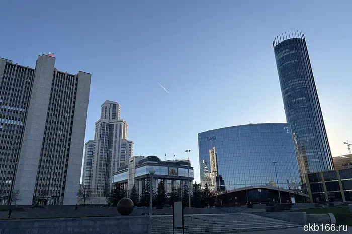
The summer heat of up to +28 degrees is coming to the Sverdlovsk region.
On May 4, 2026, a noticeable warming is expected in the Sverdlovsk region next week. Meteorologists predict that the region will be under the influence of a stable westerly air mass transfer: warm air from Europe will flow into the Urals along the northern periphery of the anticyclone, supported by a cyclone moving along the Arctic coast.
As meteorologist Alexey Pulin reports, the peak of the warming will occur on Wednesday, May 6: during the daytime, the air temperature in the region may reach +23…+28 °C, making it the warmest day of the week. However, starting Thursday, the weather conditions will begin to change. The influence of the cyclone will intensify in the region: a cold atmospheric front will approach from the northwest. Thunderstorms are possible before its arrival. On Friday, the formation of a private cyclone is expected, which will merge with the Caspian one, leading to prolonged precipitation. By the weekend, the temperature will drop: cold air will flow into the region, and frosts are possible at night. The weather will begin to be determined by an anticyclone strengthening in the cold air mass. At the beginning of next week, the situation will again become unstable: the southeast of the region will be under the influence of another cyclone. Precipitation is expected in Yekaterinburg in the first half of the day, and thunderstorms are possible in the southeast of the region.
May 5 (Tue): night +8 °C, day +23 °C;
May 6 (Wed): night +12 °C, day +26 °C;
May 7 (Thu): night +12 °C, day +24 °C;
May 8 (Fri): night +11 °C, day +18 °C;
May 9 (Sat): night +6 °C, day +13 °C;
May 10 (Sun): night +3 °C, day +15 °C;
May 11 (Mon): night +5 °C, day +13 °C.

Другие Новости Екатеринбурга (ЕКБ166)
 Stars of Russian cinema and sports congratulated the RMK Academy of Martial Arts on its birthday.
Pavel Volya, Mikhail Galustyan, Dmitry Bivol, and many other well-known representatives of theater, cinema, and sports congratulated the RMK Academy of Martial Arts on its birthday.
Stars of Russian cinema and sports congratulated the RMK Academy of Martial Arts on its birthday.
Pavel Volya, Mikhail Galustyan, Dmitry Bivol, and many other well-known representatives of theater, cinema, and sports congratulated the RMK Academy of Martial Arts on its birthday.
 The regime of drone danger has been lifted in the Sverdlovsk region.
In the Sverdlovsk region, the drone danger regime has been lifted. Recall that the corresponding regime was introduced in the region on the morning of May 4 at 9 o'clock. By the way, many received the SMS only recently.
The regime of drone danger has been lifted in the Sverdlovsk region.
In the Sverdlovsk region, the drone danger regime has been lifted. Recall that the corresponding regime was introduced in the region on the morning of May 4 at 9 o'clock. By the way, many received the SMS only recently.
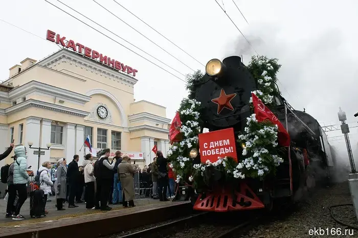 The retro train "Echelon of Victory" has arrived in Yekaterinburg.
The "Victory Train" has arrived in Yekaterinburg. You can visit the retro train powered by a steam locomotive from 9:50 AM to 3:30 PM. Guided tours of the themed carriages have been prepared for visitors.
The retro train "Echelon of Victory" has arrived in Yekaterinburg.
The "Victory Train" has arrived in Yekaterinburg. You can visit the retro train powered by a steam locomotive from 9:50 AM to 3:30 PM. Guided tours of the themed carriages have been prepared for visitors.
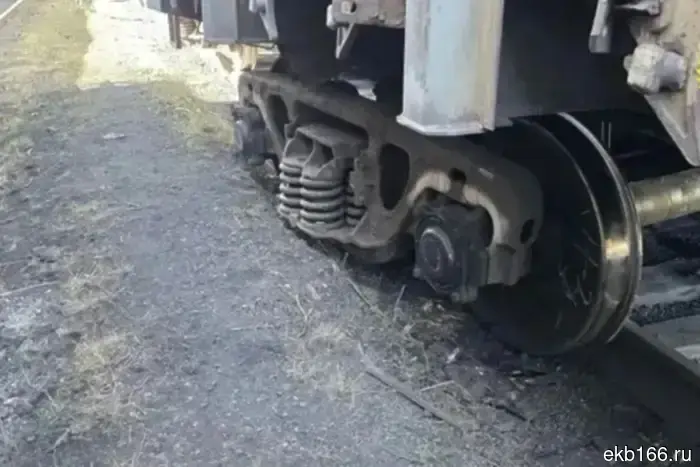 In the Sverdlovsk region, a wagon with concentrate derailed.
On the eve of May 3, a wagon with concentrate derailed in Nizhny Tagil. This happened at the Smychka station of the Sverdlovsk railway. This was reported by the Ural Transport Prosecutor's Office.
In the Sverdlovsk region, a wagon with concentrate derailed.
On the eve of May 3, a wagon with concentrate derailed in Nizhny Tagil. This happened at the Smychka station of the Sverdlovsk railway. This was reported by the Ural Transport Prosecutor's Office.
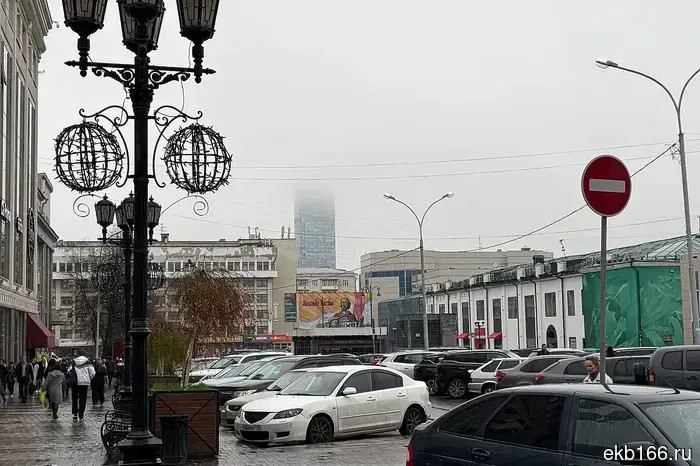 Fog and rain covered Yekaterinburg since morning.
The upcoming week, according to meteorologists, promises to be truly summer-like and hot, but for now, it doesn't seem that way... On Monday morning, the city was engulfed in thick fog.
Fog and rain covered Yekaterinburg since morning.
The upcoming week, according to meteorologists, promises to be truly summer-like and hot, but for now, it doesn't seem that way... On Monday morning, the city was engulfed in thick fog.
 Media: Cultural sites in Yekaterinburg will be transferred to military enlistment offices for mobilization.
According to the publication "Signal Ural," Yekaterinburg is to transfer buildings, structures, communications, land, and transport of cultural facilities to the military enlistment offices for free use.
Media: Cultural sites in Yekaterinburg will be transferred to military enlistment offices for mobilization.
According to the publication "Signal Ural," Yekaterinburg is to transfer buildings, structures, communications, land, and transport of cultural facilities to the military enlistment offices for free use.
The summer heat of up to +28 degrees is coming to the Sverdlovsk region.
In the Sverdlovsk region, a noticeable warming is expected next week. Forecasters predict that the region will be under the influence of a stable westerly air mass transfer: warm air from Europe will flow into the Urals along the northern periphery of the anticyclone, supported by a cyclone moving along the Arctic coast.